Global geodetic reference frame
A high-precision global geodetic reference frame is the fundamental basis for applications that require georeferencing. Such a consistent global frame is essential to determine precise orbits of satellites used for e.g. communications, navigation, or meteorological purposes. Technologies such as autonomous driving, or precision farming would be inconceivable without Global Navigation Satellite Systems (GNSS). Earthquakes, volcanic eruptions or tsunamis are caused by deformations of the Earth's crust. To detect these deformations by early warning systems for natural hazards, precise geodetic observations and a consistent spatial reference are the fundamental backbone.
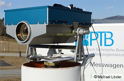
Sea level rise is indisputably correlated with climate changes and global warming of the Earth. During the past decade, the global mean sea level rises by about 2-3 mm per year. Monitoring such small global changes requires a global geodetic reference frame. The specified requirement is 1 mm reference frame accuracy and 0.1 mm per year stability in time. Current terrestrial reference frames, such as the International Terrestrial Reference Frame (ITRF), are inaccurate by at least a factor of 5 and, hence, are identified as one of the limiting factors. In 2003, the International Association of Geodesy (IAG) established the Global Geodetic Observing System (GGOS) to provide geodetic observations, which describe the shape, the rotation, and the mass distribution of the Earth. Moreover, GGOS provides products of highest accuracy and consistency to derive a global geodetic reference frame. The goal is an accuracy of 1 mm and 0.1 ppb for position and scale, respectively, and a stability of 0.1 mm per year and 0.01 ppb per year. Here, 1 ppb (parts per billion) corresponds to a change of about 6 mm on the Earth's surface.
Realisation of global reference frame
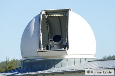
A global geodetic reference frame results from the combination process of several space geodetic techniques such as
- Global Navigation Satellite System (GNSS),
- Satellite Laser Ranging (SLR),
- Doppler Orbitography and Radiopositioning Integrated by Satellite (DORIS), and
- Very Long Baseline Interferometry (VLBI).
The reference points of these space geodetic techniques correspond to the physical positions of the realised frame on the Earth's surface. Due to the weak physical connection between the space geodetic techniques, additional geometric information are needed to obtain a robust and reliable frame. For that reason, locally observed and determined vectors are introduced to the combination process. These vectors are known as Local Ties and are defined between the conventional reference points of space geodetic techniques. Local Ties can be determined by high-precision local measurements at so-called multi-technique stations (co-location stations). A multi-technique station is a site that hosts and operates at least two different space geodetic techniques. Local Ties are a crucial component because the vectors combine the space geodetic techniques to a consistent and integrated sensor on Earth.
Objective of GeoMetre
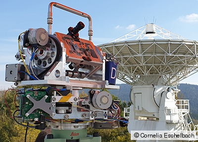
Improving the traceability of geodetic length measurement to the SI meter is the overall project goal of the international research project GeoMetre (Large-Scale Dimensional Measurements for Geodesy, JRP 18SIB01). This research project is funded by the EMPIR programme and the European Union's Horizon 2020 research and innovation programme. The specific objectives of GeoMetre are:
- To develop and validate field-capable primary or transfer standards to disseminate the unit metre over reference baselines over distances of at least 5 km with a measurement uncertainty below 1 mm.
- To develop and validate 3D capable novel measurement devices with a measurement range of operation of 50 m and an accuracy of better than 50 μm outdoors, capable of compensating fast variations of the index of refraction at a relative uncertainty level better than 1 μm/m.
- To develop technologies, methods, and uncertainty assessment for the Earth-bound SI-traceable verification of space-geodetic measurement technologies like GNSS or SLR over distances of at least 5 km with uncertainties of 1 mm or better and their implementation in a European reference standard.
- To reduce uncertainty of the so-called Local Tie between co-located space geodetic techniques at GGOS-CS (and all other eligible sites) by one order of magnitude to 1 mm over 200 m in real time continuous tracking. This requires a coordinated effort of novel dimensional measurement systems, methodology and analysis strategies and their demonstration in pilot studies at 2 European GGOS-CS.
- To facilitate the take up of the technology and measurement infrastructure developed in the project by the European geodetic measurement infrastructure by provision of European-wide access to the developed high-level references, collaboration with the established existing measurement supply chain (accredited laboratories, instrumentation manufacturers), and dissemination to standards developing organisations (ISO, IAG working groups) and end users (geodesy, surveying, high energy physics, and Earth sciences).
Laboratory for Industrial Metrology
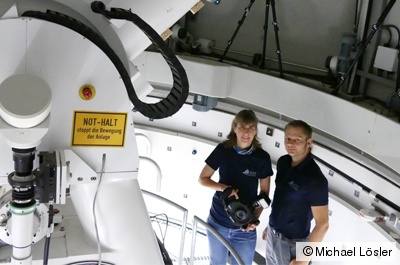
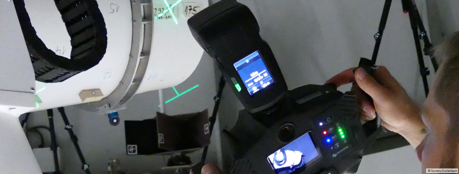
The Laboratory for Industrial Metrology of the Frankfurt University of Applied Sciences is one out of 16 European partners in this research project. The scientists of the Laboratory for Industrial Metrology develop novel analysis strategies that are able to compensate for variations in the refractive index of air, which bias terrestrial observations. Innovative mathematical models are derived for determining the conventional reference point of telescopes used for SLR and VLBI. These models allow for an in-situ reference point determination during the regular station process. Further investigations focus on the main reflector deformations of radio telescopes, which lead to variations in the signal path and, if unconsidered, yield systematic delay errors.
Geodesy - The Science of Earth Measurement
Funding
This project 18SIB01 GeoMetre (Large-Scale Dimensional Measurements for Geodesy) has received funding from the EMPIR programme co-financed by the Participating States and from the European Union's Horizon 2020 research and innovation programme. DOI: 10.13039/100014132.
Guillory, J., Truong, D., Wallerand, J.-P., Lösler, M., Eschelbach, C., Mähler, S., Klügel, T.: Determination of the reference point of a radio telescope using a multilateration-based coordinate measurement prototype. Precision Engineering, 83, pp. 69-81, 2023. DOI: 10.1016/j.precisioneng.2023.05.007
Lösler, M., Eschelbach, C., Mähler, S., Guillory, J., Truong, D., Wallerand, J.-P.: Operator-Software Impact in Local Tie Networks: Case study at Geodetic Observatory Wettzell. Applied Geomatics, 15, pp. 77-95, 2023. DOI: 10.1007/s12518-022-00477-5
Lösler, M., Eschelbach, C.: Novel approaches to reference point monitoring. GeoMetre – Final Progress Meeting, 21-22 November 2022, Główny Urząd Miar (GUM), Warsaw, Poland, 2022.
Pollinger, F., Eschelbach, C., Courde, C., GarciaAsenjo, L., Guillory, J., Hedekvist, P.O., Kallio, U., Klügel, T., Lösler, M., Neyezhmakov, P., Pesce, D., Pisani, M., Seppä, J., Underwood, R., Wezka, K., Wiśniewski, M. (for the GeoMetre Consortium): The GeoMetre project: a comprehensive study to advance local tie metrology. In: IAG International Symposium on Reference Frames for Applications in Geosciences (REFAG 2022), Global Reference Frame Theory, Concepts and Computations, 17-20 October 2022, Thessaloniki, Greece, 2022.
Lösler, M., Eschelbach, C., Greiwe, A., Brechtken, R., Plötz, C., Kronschnabl, G., Neidhardt, A.: Ray Tracing-Based Delay Model for Compensating Gravitational Deformations of VLBI Radio Telescopes. Journal of Geodetic Science, 12(1), pp. 165-184, 2022. DOI: 10.1515/jogs-2022-0141
Lösler, M., Eschelbach, C.: Reference Point Determination Using Photogrammetry. Unified Analysis Workshop (UAW), Aristotle University of Thessaloniki, 21-23 October 2022, Thessaloniki, Greece, 2022.
Eschelbach, C., Lösler, M.: A Feasibility Study for Accelerated Reference Point Determination Using Close Range Photogrammetry. In: García-Asenjo, L., Lerma, J. L. (eds.): 5th Joint International Symposium on Deformation Monitoring (JISDM), Editorial Universitat Politècnica de València, Spain, pp. 1-8, 2022. DOI: 10.4995/JISDM2022.2022.13417
Pollinger, F., Baselga, S., Courde, C., Eschelbach, C., García-Asenjo, L., Garrigues, P., Guillory, J., Hedekvist, P. O., Helojärvi, T., Jokela, J., Kallio, U., Klügel, T., Köchert, P., Lösler, M., Luján, R., Meyer, T., Neyezhmakov, P., Pesce, D., Pisani, M., Poutanen, M., Prellinger, H., Röse, A., Seppä, J., Truong, D., Underwood, R., Wezka, K., Wallerand, J.-P., Wiśniewski, M.: The European GeoMetre project – developing enhanced large-scale dimensional metrology for geodesy. Applied Geomatics, 2023. DOI: 10.1007/s12518-022-00487-3
Lösler, M., Eschelbach, C., Klügel, T.: Close Range Photogrammetry for High-Precision Reference Point Determination: A Proof of Concept at Satellite Observing System Wettzell. In: Freymueller, J. T., Sánchez, L. (eds.): Geodesy for a Sustainable Earth, Scientific Assembly of the International Association of Geodesy (IAG), Vol. 154, Springer, Berlin, pp. 57-65, 2022. DOI: 10.1007/1345_2022_141
Eschelbach, C., Lösler, M., Klügel, T., Riepl, S., Mähler, S., Pollinger, F.: Zum Einsatz der Nahbereichsphotogrammetrie zur Referenzpunktbestimmung an SLR-Teleskopen. Frontiers of Geodetic Science, Geodätische Referenzsysteme und Erdrotation, 22-23 September 2021, Hanover, Germany, 2021.
Eschelbach, C., Lösler, M., Guillory, J., Truong, D., Wallerand, J.-P., Röse, A., Köchert, P., Prellinger, G., Meyer, T., Pollinger, F.: Vom Kleinen zum Großen: Ein Zwischenbericht zum EMPIR-Projekt GeoMetre. VDVmagazin - Zeitschrift für Geodäsie und Geoinformatik, 72(5), pp. 354-361, 2021.
Pollinger, F., Courde, C., Eschelbach, C., Garcia-Asenjo, L., Guillory, J., Hedekvist, P., Kallio, U., Klügel, T., Neyezhmakov, P., Pesce, D., Pisani, M., Seppä, J., Underwood, R., Wezka, K., Wiśniewski, M. (for the GeoMetre Consortium): Large-Scale Dimensional Metrology for Geodesy — First Results from the European GeoMetre Project. In: Freymueller, J. T., Sánchez, L. (eds.): Geodesy for a Sustainable Earth, Scientific Assembly of the International Association of Geodesy (IAG), Vol. 154, Springer, Berlin, pp. 105-110, 2022. DOI: 10.1007/1345_2022_168
Lösler, M., Eschelbach, C., Holst, C.: On the Impact of the Coordinate Representation onto the Estimates in Least-Squares Adjustment. In: Haas, R. (ed.): Proceedings of the 25th European VLBI for Geodesy and Astrometry (EVGA) Working Meeting, 14-18 March 2021, Chalmers University of Technology, Gothenburg, Sweden, pp. 49-55, 2021. ISBN: 78-91-88041-41-8
Lösler, M., Eschelbach, C., Klügel, T., Riepl, S.: ILRS Reference Point Determination using Close Range Photogrammetry. Applied Sciences, 11(6), 2785, 2021. DOI: 10.3390/app11062785
Lösler, M.: Modeling for signal path and in-situ reference point determination of VLBI radio telescopes. Committee for Geodesy (DGK) of the Bavarian Academy of Sciences and Humanities, Series C, 865, Munich, 2021, ISBN: 978-3-7696-5277-2; Identical with: Scientific publications of the Institute of Geodesy and Geoinformation Science, Geodesy and Adjustment Theory, Technische Universität Berlin, 2021. DOI: 10.14279/depositonce-11364
Lösler, M.: Zur Parameterschätzung mit unterschiedlichen Koordinatendarstellungen. Zeitschrift für Geodäsie, Geoinformatik und Landmanagement (ZfV), 145(6), pp. 385-392, 2020, DOI: 10.12902/zfv-0319-2020
Lösler, M., Eschelbach, C.: Close Range Photogrammetry for Reference Point Determination. GeoMetre - 2nd Progress Meeting, 17-18 November, 2020.
Eschelbach, C., Lösler, M., Haas, R., Greiwe, A.: Untersuchung von Hauptreflektordeformationen an VGOS-Teleskopen mittels UAS. In: Wunderlich, T. A. (ed.): Ingenieurvermessung 20: Beiträge zum 19. Internationalen Ingenieurvermessungskurs, Munich, 3-6 March 2020, Wichmann, pp. 411-424, 2020, ISBN: 978-3-87907-672-7
Eschelbach, C., Lösler, M.: Photogrammetry for Accelerated Reference Point Monitoring - New Model for Reference Point Determination. GeoMetre - 1st Progress Meeting, 24-25 February 2020, Conservatoire National des Arts et Métiers (CNAM), Paris, France, 2020.
Lösler, M., Haas, R., Eschelbach, C., Greiwe, A.: Gravitational Deformation of Ring-Focus Antennas for VGOS - First Investigations at the Onsala Twin Telescopes Project. Journal of Geodesy, 93(10), pp. 2069-2087, 2019, DOI: 10.1007/s00190-019-01302-5
Lösler, M., Eschelbach, C., Riepl, S., Schüler, T.: A Modified Approach for Process-Integrated Reference Point Determination. In: Haas, R., García-Espada, S., Lopez Fernández, J. A.: Proceedings of the 24th European VLBI for Geodesy and Astrometry (EVGA) Working Meeting, 17-19 March 2019, Las Palmas de Gran Canaria, Spain, pp. 172-176, 2019. ISBN: 978-84-416-5634-5
Lösler, M., Eschelbach, C., Riepl, S., Schüler, T.: Zur Bestimmung des ILRS-Referenzpunktes am Satellite Observing System Wettzell. In: Luhmann, T., Schumacher, C. (eds.): Photogrammetrie - Laserscanning - Optische 3D-Messtechnik: Beiträge der 18. Oldenburger 3D-Tage 2019, Wichmann, pp. 162-175, 2019. ISBN: 978-3-87907-660-4
Lösler, M., Eschelbach, C., Haas, R., Greiwe, A.: Measuring Focal-Length Variations of VGOS Telescopes Using Unmanned Aerial Systems. In: Haas, R., García-Espada, S., Lopez Fernández, J. A. (eds.): Proceedings of the 24th European VLBI for Geodesy and Astrometry (EVGA) Working Meeting, 17-19 March 2019, Las Palmas de Gran Canaria, Spain, pp. 17-21, 2019. ISBN: 978-84-416-5634-5
Prof. Dr.-Ing.
Cornelia Eschelbach
Phone: +49 (0) 69 1533-2356
cornelia.eschelbach(at)fb1.fra-uas.de
Dr.-Ing.
Michael Lösler
Phone: +49 (0) 69 1533-2784
michael.loesler(at)fb1.fra-uas.de
Address
Transfer centre
Steinbeis Transfer Centre Applied Geodesy
https://applied-geodesy.org
Member of SCGD
Member of the Society for Calibration of Geodetic Devices e.V. (SCGD)
Project partners
- Physical-Technical Federal Institute
- Conservatoire national des arts et métiers
- Central Office of Measures
- Istituto Nazionale di Ricerca Metrologica
- National Land Survey of Finland
- National Physical Laboratory Management Limited
- Research Institutes of Sweden AB
- Technical Research Centre of Finland
- Federal Agency for Cartography and Geodesy
- Centre National de la Recherche Scientifique
- Institute national de l'information géographique et forestière
- National Scientific Centre Institute of Metrology
- Universitat Politècnica de València
- Politechnika Warszawska
- Observatoire de la Côte d'Azur
Press Releases
Determine reference points for laser telescopes easily(er)
First results of the EU research project "GeoMetre": Frankfurt UAS develops new algorithm for measurement processes (in German; 12/2020)
The more reliable the length measurement, the more reliable the statements about environmental changes
Researchers at Frankfurt UAS contribute to the development of new measurement methods in geodesy in the EU research project "GeoMetre" (in German; 05/2023)

